


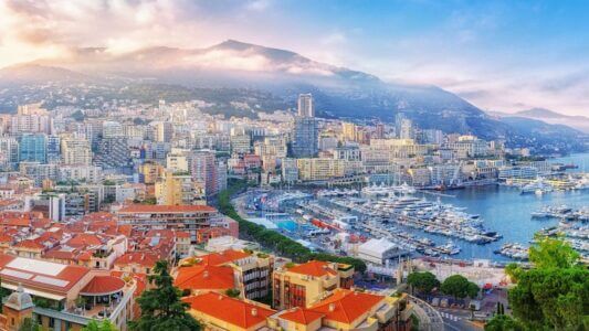
7 hikes to do near Monaco, sorted by difficulty

Set off from Monaco and follow the Cap-d'Ail coastal path during the summer months for an easy walk by the sea © Monaco Tribune
Discover the most picturesque walks and hikes near the Principality, from easy coastal paths to challenging climbs.
Whether you are a beginner looking for a family stroll or a seasoned hiker after a sporting challenge, these seven trails will let you discover the most fabulous panoramas of the French Riviera, some with breathtaking views of Monaco.
Easy walks
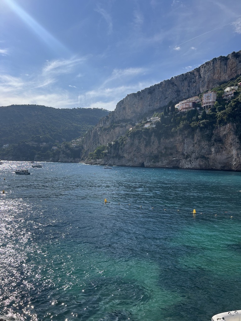
Cap-d’Ail coastal trail
This easy walk from Marquet beach takes you around three stunning headlands, full of vegetation and geological curiosities. The 4-kilometre round trip follows the coastline and provides panoramic views of the French Riviera, from the Principality to the Saint-Jean-Cap-Ferrat peninsula. This seaside trail takes you to the famous Mala beach, a real gem in a cove with crystal-clear waters. Mala beach can be very busy in the summer.
© Benjamin Godart Monaco Tribune
Mala beach is only accessible on foot and is very popular for its turquoise waters and La Réserve restaurant The pathway crosses Cap Mala via steps that overlook the sea and passes by a picnic area with facilities. There is a variety of landscapes, including Cap d’Ail’s volcanic rocks, huge limestone cliffs and sea caves accessible to adventurous swimmers.
Practical info: Leave from Marquet beach (next to Cap d’Ail harbour), approximately 2 hours’ walk, sports shoes recommended. Please check weather conditions: the trail is closed in strong winds.
Round Cap d’Antibes
The Cap d’Antibes coastal path offers a 4.8-kilometre walk the whole family can enjoy. This legendary route winds its way between sumptuous Belle Époque villas and wild coves, with spectacular views of the Lérins Islands and the Bay of Cannes. The path allows you to discover the diversity of Mediterranean flora: Aleppo pines, holm oaks, mastic trees and fragrant rockroses. There are several beaches along the way, including Garoupe Beach, ideal for a swim. The Garoupe lighthouse, the highest point of the cape at 103 metres, rewards walkers with a 360-degree panorama.
Practical info: Leave from the Salis beach car park, 2½-hour walk, open all year round, ideal for families with children.
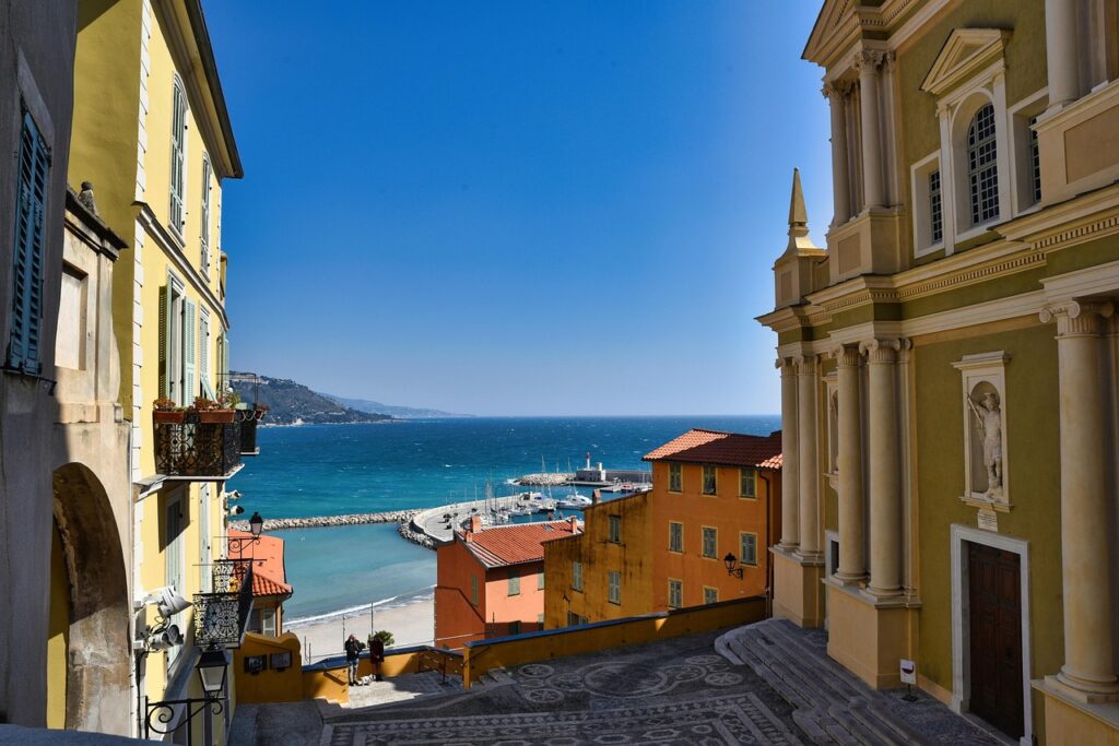
The Roquebrune-Cap-Martin coastal path
On the other side of Monaco, the ‘Tour du Cap Martin’ in Roquebrune also offers a 4.6-kilometre walk (two hours there and back) along the coast. Easy to follow, it is ideal for families and lets you discover beautiful villas on the Mediterranean coast, such as the Villa Cyrnos, occupied at the beginning of the century by Empress Eugénie, wife of Napoleon III, plus the famous cabin of the architect and urban planner Le Corbusier.
Practical info: to get there, from Carnolès station, head towards the coast and follow it to the right towards Cap Martin. Then take Avenue W. Churchill (on the left), which leads to the end of the cape.
Intermediate level hikes
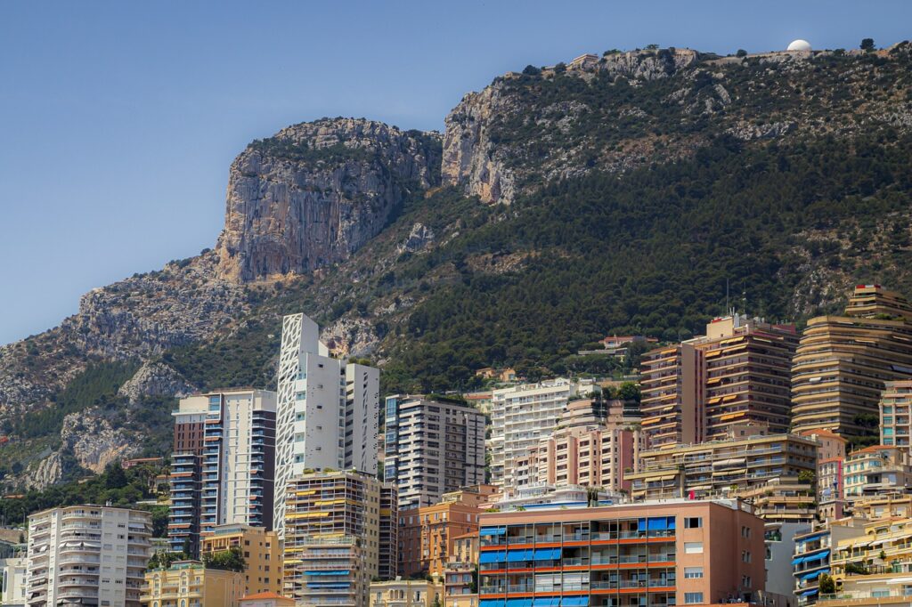
- La Tête de Chien – Panoramic view of Monaco
This intermediate hike leads to the famous Tête de Chien viewpoint (550 m), one of the most beautiful views on the French Riviera. Starting from La Turbie, the well-marked trail crosses the steep slopes and white limestone cliffs that are characteristic of this rocky outcrop. The route starts at La Turbie town hall, following Avenue Edward Tuck, then Route de la Tête de Chien to the car park near the military fort, which is closed to the public. From there, a dirt track leads to the Rondo viewpoint in a few minutes. From the top, you can enjoy an exceptional panorama. The view is magnificent, with Monaco on the left and Saint-Jean-Cap-Ferrat on the right, which can also be enjoyed at sunset. The site is very popular with hikers, so you are likely to come across other people during your excursion. For the return journey, hikers have two options: the direct route via the same itinerary, or a longer circuit following markers 604, 603 and 602, which leads down to La Turbie via a forest path.
Practical info: Leave from La Turbie, 3-hour round trip, elevation gain 400m, open all year round. Bring good shoes and water.
- Menton to Monaco
This 11-kilometre hike along the Mediterranean connects the two towns, winding between land and sea. The path includes exceptional coastal landscapes and passes through Monaco’s old town, astride its rock. The itinerary follows the ‘sentier des douaniers’ (customs officers’ path) and passes by Buse beach in Roquebrune-Cap-Martin, perfect for a refreshing break. The views of Roquebrune Bay and the cliffs of Cap-Martin are particularly striking. The route takes an average of 3 hours with an elevation gain of 300 metres.
Practical info: Leave from Menton or Monaco, intermediate level, many stairs, little shade. We recommend taking public transport for the return journey.
Expert level hikes
- Around the Roc d’Orméa
Starting from Menton, this challenging hike takes you to the summit of one of the highest peaks on the French Riviera. Towering 1,132 metres above the beaches of Menton, it provides a unique panorama of the entire coastline and Alpine peaks. This 14-kilometre hike, recommended for experienced walkers, takes you through all the different landscapes of the Mediterranean hinterland. The trail reveals historical treasures: the ruins of the ancient village of Castellar and the Pendimoun shelter, a prehistoric site dating back to the Neolithic period. The climb passes through different types of vegetation, from coastal scrubland to alpine meadows. After several kilometres between Menton and Castellar, the view from the summit is a reward for this long hike.
Practical info: Leave from Menton, 6 hour walk, 1,100 metres of elevation gain, very difficult. Reserved for experienced hikers, mountain equipment essential.
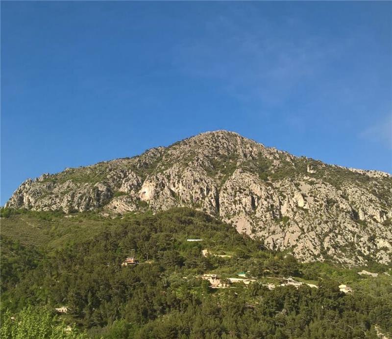
- Round Mont Agel
This 12-kilometre circuit around Mont Agel is one of the most challenging hikes in the Monaco area. The summit is topped by a large plateau at an altitude of 1,151 metres and is very popular with trail runners. The trail provides some exceptional views of the Mediterranean on one side and the Pre-Alps on the other. The route passes through varied landscapes: oak and pine forests, high-altitude meadows and rocky outcrops. The remains of military fortifications bear witness to the strategic importance of the site. From the summit, on a clear day, the view stretches from the Estérel to the west and the Italian Alps to the east, encompassing the entire French-Italian Riviera. The trail has some technical sections requiring a good physical condition and mountain experience. These peaks offer one of the most beautiful panoramic views of the southern part of the Alpes-Maritimes.
Practical info: Leave from La Turbie, 5 hour walk, 800m elevation gain, expert level. Full hiking equipment required, avoid in bad weather.
Practical tips
To make the most of these outings, choose between October and May to avoid the summer heat. Always take plenty of water and sunscreen with you. Coastal paths may be closed in strong winds or rough seas. Access by public transport is easy thanks to the regional rail network, which serves most of the starting points. The stations in Monaco, Cap-d’Ail, Menton and Antibes are excellent starting points for each of these walks.